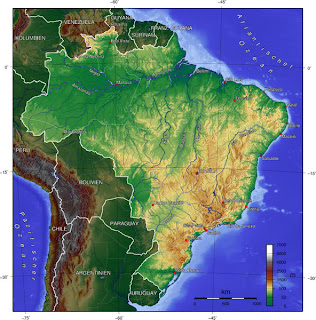
This is a Topographic Map of South America which includes terrestrial elevation. It uses contour lines to portray relief including the shape and elevation of the land. Topographic maps capture the three-dimensional aspect of terrain on two-dimensional surface. It identifies hills, draws, cliffs, spurs, ridges, valleys, saddles, and depressions. If you look at this map of South America you can see the contour lines and the different colors throughout the different countries displaying the elevation of the land .
http://www.google.com/imgres?imgurl=http://www.brazadv.com/images/topographic%2520map%2520brazil.jpg&imgrefurl=http://mapstothet.blogspot.com/2008_10_01_archive.html&h=600&w=592&sz=130&tbnid=HJJQ7d746Gp77M:&tbnh=227&tbnw=223&prev=/images%3Fq%3Dtopographic%2Bmap&usg=__3gby_49kzyGqbsIOYWVANHYa0SA=&ei=6NzRS57INo-48wSDg_3IDw&sa=X&oi=image_result&resnum=2&ct=image&ved=0CA8Q9QEwAQ
No comments:
Post a Comment